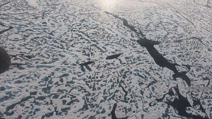
Reward for best AI-based map of drifting sea ice in the Arctic

With DTU Space as co-organiser, ESA has challenged researchers and students in Europe with a contest to create the best maps of drifting sea ice in the Arctic using satellite data and AI. The winners will get 3,000 Euros and expert feedback. More than 100 teams are participating.
Researchers at DTU Space are working hard to develop models that can map the sea ice automatically in the Arctic waters. This is done using satellite data and artificial intelligence (AI).
The sea ice in the Arctic waters around Greenland is constantly moving. Good quality and updated maps of the ice are therefore an important tool to ensure ships can navigate safely in the region.
In order to get fresh ideas for sea ice mapping, DTU Space researchers are co-organising the AutoICE competition in collaboration with the European Space Agency ESA and other partners such as the Danish Meteorological Institute DMI. Here researchers and students across Europe are invited to come up with proposals for models that can produce maps of the sea ice automatically based on AI.
The challenge aims to harness the collective expertise and innovation of the AI and Earth Observation community to make significant strides in understanding and monitoring sea ice.
"The main purpose of the competition is to involve more people in solving the problem. Furthermore, we would like to have new ideas and proposed solutions for how to ensure the most robust and accurate maps of the sea ice based on automated and AI-driven data processing of satellite data," says Ph.D. student at DTU Space, Andreas Stokholm.
"More than 100 teams are participating in the contest. And we are looking forward to take a closer look at their proposed solutions when the competition ends in April."
Andreas Stokholm is also developing sea ice mapping models using AI as part of his Ph.D. project. He is a co-organiser of the contest together with DTU Space colleague Roberto Saldo.
Information about sea ice can also be used in weather and climate models.
Faster and cheaper shipping routes via the Arctic
The extent of sea ice in the Arctic is decreasing as a result of climate change. This increases the possibility of establishing new and shorter shipping routes via Arctic waters.
For example, 13 days and 10 percent of the costs for the trip can be reduced if a shipping route between South Korea and Denmark can go via the Arctic instead of the Suez Canal.
"As there is more ship traffic in the seas around the Arctic, the need for more precise maps of the sea ice increases in order to navigate safely and efficiently. The sea ice is constantly moving and its extent is changing, so it is a big challenge. Research also shows that the Arctic sea ice cover will become more dynamic when there is less ice," explains Andreas Stokholm.
A large part of ice mapping is manual today
Today, a large part of the ice mapping is done manually by experts inspecting and analysing satellite radar images of the ice. With the help of a computer, new ice maps are then drawn daily.
This is the process that the researchers want to automate and make more accurate by using artificial intelligence to process satellite data.
For the competition, the participants get access to a data set of satellite radar images and ice maps made by professional ice analysts.
For example images from the European ESA Sentinel 1 satellites, which cover the Arctic from an orbit about 700 km above the Earth, are being used. These satellites are equipped with a SAR unit (Synthetic Aperture Radar), which can 'see' the ice and map it around the clock, even when it is dark and cloudy.
Provided by Technical University of Denmark