Next-generation underwater lidar technology aims to map the ocean floor in remarkable detail

Imaging the structure of the deep seafloor is critical to understanding the biology and ecology of the largest living space on our planet. But to date, only about 20% of the ocean floor has been mapped at a resolution useful for scientific study.
For the past 10 years, MBARI has worked with 3D at Depth to develop innovative tools to map the seafloor using lidar technology. Now, this partnership aims to create the next generation of subsea lidar technology that can generate detailed high-resolution maps of underwater features.
"To meet our goal of surveying the complex and rugged terrain of the deep seafloor at one-centimeter resolution, we're working closely with 3D at Depth to develop enhanced lidar technology that will be smaller in size and weight and require less power, making it ideal for deployment on MBARI's robotic submersibles and eventually, our autonomous robots too," said Dave Caress, a principal engineer at MBARI and the principal investigator of MBARI's Seafloor Mapping Lab.
"We're excited that a research organization such as MBARI continues to use and invest in our technology to meet one of their strategic goals. These projects are truly a win-win for both organizations as it provides MBARI with a tool to meet their scientific goals and helps us improve our subsea lidar systems for diverse robotic platforms," said 3D at Depth CEO Carl Embry.
The ocean covers roughly 70% of the Earth's surface. Beneath its sapphire surface lies a complex terrain—expansive plains, towering seamounts, deep submarine canyons, and chasm-like trenches. Blending multi-scale seafloor mapping, imaging, targeted sampling, and novel sensors with precision navigation, MBARI has developed the capability to conduct efficient, high-resolution, and repeatable surveys of deep-sea research sites off Central California and beyond.

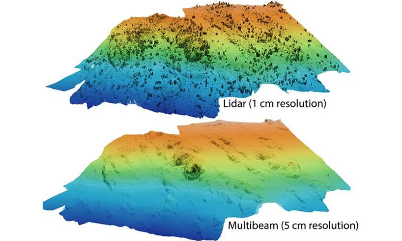
MBARI's efforts to develop seafloor mapping technology first began more than 20 years ago. In 2006, MBARI started using Dorado-class autonomous underwater vehicles (AUVs) to map the ocean floor to one-meter (3.3-feet) resolution. In 2011, the seafloor mapping team began using remotely operated vehicles (ROVs) as platforms for high-resolution low-altitude surveys of the seafloor. The ROVs use sound (sonar), lasers (lidar), stereo photography, and inertial navigation systems to produce maps of the seafloor in incredibly detailed one-centimeter (0.4-inch) resolution.
MBARI's partnership with 3D at Depth, a global expert in commercial subsea lidar technology, has been critical to this effort.
Lidar, or light detection and ranging, uses a laser to reconstruct three-dimensional terrain. Subsea lidar uses pulses of high-intensity green laser light to collect incredibly precise information about seafloor characteristics, allowing researchers to generate detailed bathymetric maps.
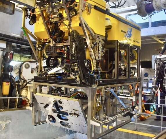
In 2013, MBARI began testing 3D at Depth's technology with the first-generation subsea lidar system, the SL1. This sensor was incorporated into the low-altitude survey system on MBARI's ROV Doc Ricketts.
The SL1 was originally designed for surveying underwater infrastructure for the oil and gas industry. It projects a two-dimensional 30-degree by 30-degree field of view, which is ideal for detailed sideways scans of wellheads and pipelines. However, this narrow coverage is not useful for down-looking, "mow-the-lawn" surveys of the seafloor.

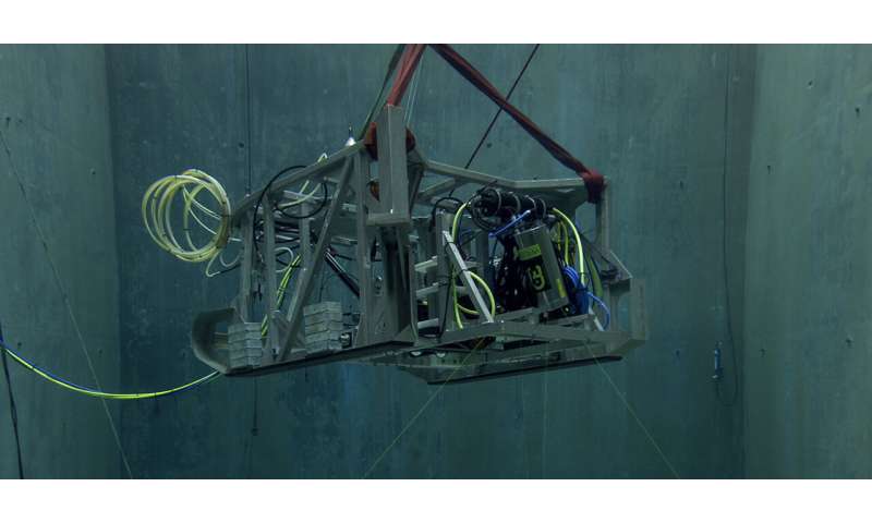
For the past seven years, MBARI and 3D at Depth have been developing a next-generation Wide Swath Subsea LiDAR (WiSSL) optimized for seafloor mapping.
In 2017, 3D at Depth delivered a WiSSL rated to 4,000 meters (13,100 feet) to meet the custom requirements for MBARI's seabed mapping campaigns, including a 90-degree field of view that covers a seafloor swath twice as wide as the distance to the seafloor. MBARI's Seafloor Mapping Lab has used the WiSSL to map a variety of seafloor features and habitats at centimeter scale, including methane gas seeps, faults, submarine canyons, deep-sea coral and sponge communities, octopus brooding sites, and high-temperature hydrothermal vents.
After completing extensive design reviews and field trials, the team now aims to build and test the next-generation subsea lidar system this year.
The next-generation WiSSL will be more portable and draw less power. The lighter system will be well suited for autonomous platforms, bringing MBARI engineers closer to their vision of integrating the low-altitude survey capability on smaller AUVs in order to flexibly scale their seafloor mapping efforts.
The new system will open up further possibilities beyond mapping the seafloor. The next-generation WiSSL will have a 360-degree field of view and be able to conduct three-dimensional scans in open water, over complex terrain, and even on vertical terrain.
Repeated mapping of the deep seafloor is essential for understanding the complexity of its landscapes, the processes that create and disrupt them, and their functions as habitat. The deep sea is critical to the health of our planet. Scientists are racing to understand the deep sea before it is forever altered by climate change, pollution, and overfishing. Working with 3D at Depth to advance lidar technologies to improve and expand seafloor mapping efforts will allow MBARI scientists to study seafloor geology and biology over large areas, particularly in areas of societal and ecological significance.
Provided by Monterey Bay Aquarium Research Institute