Ecologists describe strong desertification in northern Algeria

RUDN University ecologists and colleagues from Algeria, Greece, Egypt, and Russia have determined the scale and causes of desertification in northern Algeria. The analysis was carried out using satellite images in different ranges. Over six years, the area of usable land has decreased by 1.5–9 times. The results were published in the Egyptian Journal of Remote Sensing and Space Science.
The loss of the biological function of land is called desertification. The composition of the soil changes, the sand content increases, and the vegetation becomes poorer. Such lands can no longer be cultivated; livestock cannot graze on them. There are several regions on Earth with a high risk of desertification. One of them is North Africa. Remote monitoring using satellite images helps track desertification. However, different soil types may be difficult to distinguish by satellite data if they have high sand content. It is important to interpret the images correctly. RUDN University ecologists and colleagues from Algeria, Greece, Egypt, and Russia determined which satellite data is best suited for determining soil composition.
"There is a problem with the similarity of reflectivity between different soils with high sand content. These are, for example, sand, loamy sand and clay. Therefore, it is necessary to develop more accurate spectral indicators to distinguish soil structures easily," said Dmitry Kucher, Ph.D., head of the Scientific Center for Research, Integrated Design and Development of Urban and Agricultural Development of the RUDN University.
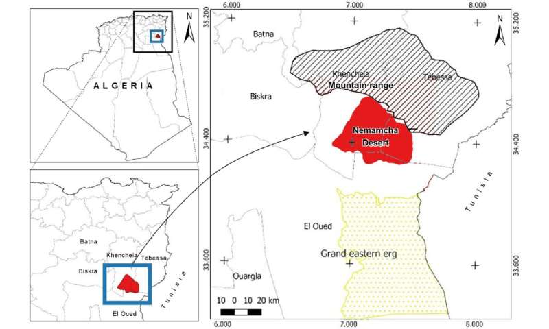
Ecologists conducted the study in the Nemamcha region in northern Algeria. This region has undergone rapid desertification. To trace spatiotemporal changes in the topsoil, RUDN University ecologists used satellite images from 2013 and 2019 and soil samples. Then they calculated the correlation between these data and analyzed the possible causes of desertification.
It turned out that blue and near-infrared images are best suited for determining the proportion of sand and clay. Using them, RUDN University ecologists built a regression model determining the composition of the soil with sufficient accuracy—the coefficient of determination (an indicator of model quality) reached 89%.
Changes in soil composition between 2013 and 2019 indicate noticeable desertification: The share of land suitable for agriculture in the region fell from 31% in 2013 to 4% in 2019, and the grazing area fell from 21% to 13%. Ecologists also named the main cause of desertification in this area—aeolian processes, that is, wind erosion and the application of sand by the wind. They turn out to be strong, among other things, because of human activity—too intensive cattle breeding and agriculture.
"We found a dominant role for aeolian processes, which are exacerbated by low topography, overgrazing, climate change, and over-intensive agriculture. We recommend investigating the protective role of dry grasslands and desert shrublands against erosion and restoring degraded lands. We urge legislators to implement remote monitoring strategies and restore vegetation to combat desertification," said Dmitry Kucher, Ph.D., Head of the Scientific Center for Research, Integrated Design and Development of Urban and Agriculture at RUDN University.
More information:
Abdelhafid Bouzekri et al, Assessment of the spatial dynamics of sandy desertification using remote sensing in Nemamcha region (Algeria), The Egyptian Journal of Remote Sensing and Space Science (2023). DOI: 10.1016/j.ejrs.2023.07.006
Provided by Russian Foundation for Basic Research