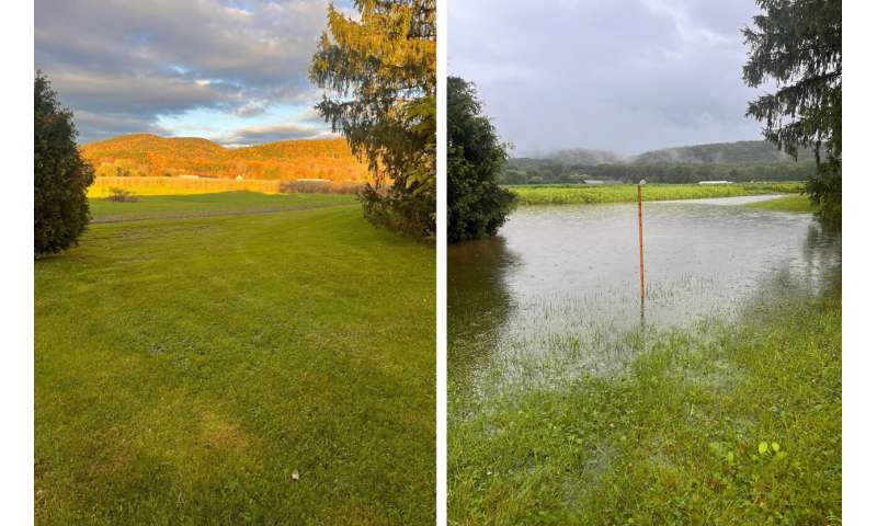
Researchers need Massachusetts citizen scientists' help to model rising groundwater

A team of researchers at the University of Massachusetts Amherst is working with Massachusetts state agencies and the public to model how climate change will continue to affect groundwater in the state, and they need your help. While many parts of the U.S. are seeing their water tables recede as the climate warms, much of New England is witnessing water levels rise—into basements, onto lawns, over crops and across roads. The team encourages members of the public to document groundwater flooding events in this brief, anonymous survey in order to better predict future groundwater flooding in Massachusetts.
"I've been working to understand how the hydrology of Massachusetts is responding to climate change and changes in land use since 2005," says David Boutt, head of the Hydrogeology Group at UMass Amherst and a professor of Earth, Geographic and Climate Sciences. "We are particularly lucky that Massachusetts has one of the most robust records of hydrological variables, such as precipitation, groundwater levels, etc., that goes back many decades."
This wealth of records previously led Boutt and his colleagues to some startling insights, among them that since 1970, precipitation has increased in New England by 15–20%. And this increased precipitation is leading to a rapid rise in groundwater levels: some places are seeing their levels rise by a few centimeters every year. While this value may seem small, the cumulative rise over decades can begin to affect sub-surface infrastructure.
Recently, the group's work caught the eye of the state's Executive Office of Energy and Environmental Affairs and Department of Conservation and Recreation, both of which asked Boutt and his colleagues to build a new model that could assess flooding risk from groundwater rise to improve that model with data from an ongoing statewide survey and to file a final report, which the group is in the process of completing.
"We built this model using high-resolution data from the Massachusetts Geological Survey depicting the depth-to-bedrock all across the state," says Dan Corkran, a graduate student in Earth, Geographic and Climate Sciences at UMass Amherst. Since groundwater flows through soil more easily than through bedrock, the amount of soil above the bedrock—the depth-to-bedrock—is an indication of how much water the aquifer can hold before groundwater turns to floodwater. "These types of large-scale datasets make our model possible," adds Corkran, who notes that the depth-to-bedrock map is the crowning achievement of Stephen Mabee, Massachusetts' state geologist and a senior lecturer in Earth, Geographic and Climate Sciences at UMass Amherst.
"This is the first-ever statewide groundwater model for Massachusetts," adds Boutt, "and it's a physical model, which means that it takes into account the physics of precipitation, evaporation and how water moves through the soil. It gives us insight into how groundwater is changing."
"Now that we have this model," says Alexander Kirshen, a research fellow at UMass Amherst who began working with the group as an undergraduate student, "we want to use the public survey to further understand how flooding has affected people and business throughout the state. The survey will also be extremely valuable to verify results from the groundwater model and get an even more accurate picture of our new hydrological reality." Kirshen is currently working with the MassGIS to publicly release the GIS data their model has created.
"This project is another critical piece of actionable science that will help inform the Healey-Driscoll Administration's risk-based adaptation to climate change," said Executive Office of Energy and Environmental Affairs Director of Water Policy Vandana Rao. "Whether it is wet basements or flooded septic systems and other subsurface infrastructure, we will be better prepared for where and how severely future groundwater flooding may occur."
The team, which includes UMass Amherst undergraduates Katie Papas and Maggie Bresee, hopes that citizen scientists across the state will help them build a new large-scale groundwater flooding dataset that will make the model an even more accurate predictor of future flooding risks
More information:
The link for the brief, anonymous survey is http://tinyurl.com/masswetbasement.
Provided by University of Massachusetts Amherst